
Using UAV-LiDAR technology to estimate carbon stocks in REDD+ projects
The Paris Agreement in 2015 marked a turning point in international climate action, with signatory countries pledging to curb greenhouse gas emissions and pursue efforts to limit global warming to 1.5°C. This ambitious goal is driven by the stark warnings from scientists about the catastrophic consequences of exceeding this threshold. The global movement to reduce carbon emissions and adopt sustainable practices is gaining momentum, but amidst the efforts of nations, a vital player has emerged - the tropical forests.
Recent scientific studies have highlighted the significance of tropical forests in mitigating global harm and climate changes. According to the Intergovernmental Panel on Climate Change (IPCC), protecting and restoring tropical forests could contribute significantly to meeting the 1.5°C target. It is estimated that these forests have the potential to absorb up to 30% of the world's CO2 emissions annually. However, tropical forests have been facing severe threats, including deforestation, illegal logging, and habitat degradation. The loss of forests not only reduces their capacity to act as carbon sinks but also releases large amounts of stored carbon back into the atmosphere.
The international community has recognized the vital role of tropical forests in the fight against climate change, driving various initiatives and programs to safeguard them. One example is the REDD+ projects: ‘REDD’ stands for ‘Reducing emissions from deforestation and forest degradation’ in developing countries. But ‘+’ means additional forest-related activities that protect the climate, namely sustainable management of forests and the conservation and enhancement of forest carbon stocks. If countries meet all the requirements, parties are eligible to seek and receive results-based payments – economic incentives for verified efforts to reduce deforestation and degradation to conserve and sustainably manage their forests.
REDD+ activities address not only deforestation but also relevant social, policy and environmental aspects. These projects should improve the quality of life of communities and preserve biodiversity, providing a win-win situation for climate protection and local communities. For instance, improvements of their livelihoods and generation of new incomes, better access to clean water and renewable energy, among others, are expected benefits.
These initiatives hold great promise in addressing the complex agricultural expansion and land use changes challenges arising from climatic changes. By integrating REDD+ strategies with sustainable agricultural practices, we can forge a path towards more resilient, carbon-neutral targets. While the potential benefits of REDD+ projects for solving agricultural problems in the face of climatic changes are evident, their success relies on a multi-stakeholder approach. Governments, NGOs, local communities, and private entities must collaborate to design and implement inclusive, transparent, and accountable REDD+ initiatives that address the specific needs of each region.
In this sense, in a groundbreaking move towards transparency and accuracy in the carbon credit market, brCarbon, a leading climate tech, is harnessing the power of cutting-edge technologies, specifically UAV-LiDAR, to revolutionize the pathway carbon credits are verified and monitored. Conventional field-based carbon measurement methods are expensive and limited spatial coverage, hampering comprehensive and precise assessments in forested regions like the Cerrado (Brazilian savanna). Remote sensing can overcome these limitations, potentially scaling up carbon stock estimates and enhancing transparency in carbon estimates in forest projects. This innovative approach not only ensures a more reliable estimation of carbon offsets but also establishes a comprehensive monitoring report to empower stakeholders and facilitate auditors in their quest for credible information. The technology captures detailed information about the structure, biomass, and health of forests, enabling brCarbon to generate more reliable data.

“The international community has recognized the vital role of tropical forests in the fight against climate change, driving various initiatives and programs to safeguard them. One example is the REDD+ projects: ‘REDD’ stands for ‘Reducing emissions from deforestation and forest degradation’ in developing countries.”
The benefits of brCarbon's innovative approach extend beyond project developers and stakeholders. Independent auditors play a crucial role in ensuring the credibility of carbon credits. With the comprehensive and accurate data provided by UAV-LiDAR, auditors can conduct more thorough and efficient verification processes, reducing the risk of erroneous estimations and enhancing the overall credibility of carbon credit projects. We successfully employed LiDAR remote sensing embarked on Unmanned Aerial Vehicle (UAV) in two REDD+ projects in the Brazilian Amazon. Thus, UAV-LiDAR provides highly accurate and detailed data acquisition capabilities, facilitating identifying subtle changes in forest structure indicative of degradation, such as biomass loss.
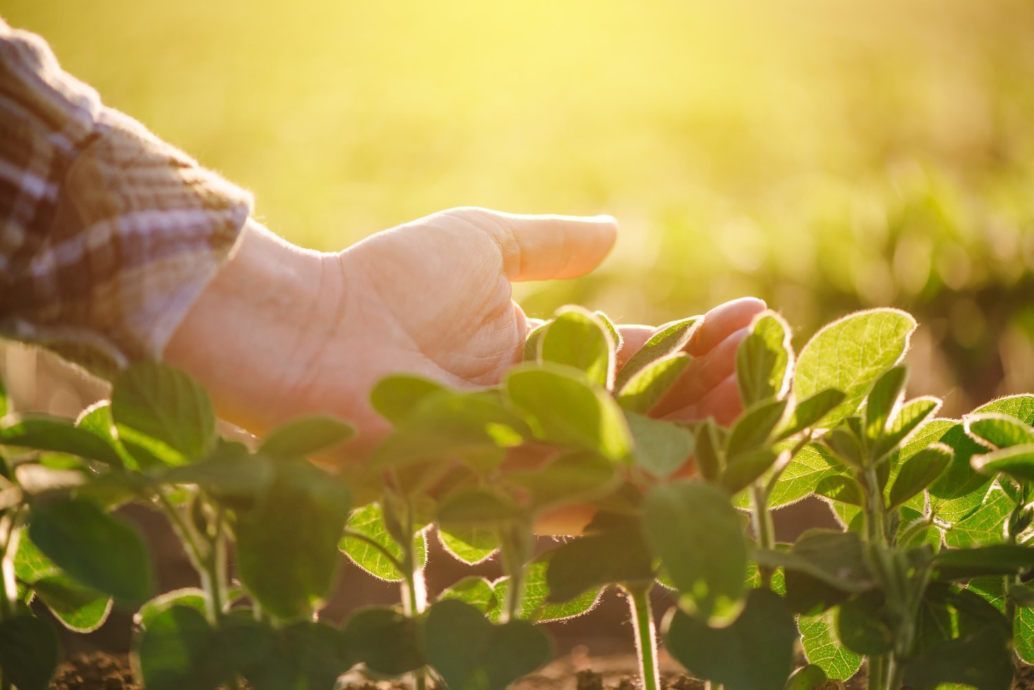
As the global community intensifies its efforts to mitigate climate change, brCarbon's REDD+ projects have emerged as a vital force in addressing environmental challenges while striking a balance with agricultural expansion, such as in the MATOPIBA region, that encompassing parts of the Brazilian states of Maranhão, Tocantins, Piauí, and Bahia. MATOPIBA has witnessed rapid agricultural expansion in recent years, driven by the soybean industry. According to the Deforestation Annual Report (RAD) from MapBiomas, with more than 540 thousand hectares of deforestation, the MATOPIBA region accounted for 26% of Brazil's total deforested area in 2022. This represents an increase of 37% when comparing with the 2021 MATOPIBA deforestation rates. One of the key elements of brCarbon's REDD+ projects is the establishment of carbon credits based on avoided deforestation and forest degradation and has been joined by a remarkable group of partners committed to making a difference.
In a significant stride towards sustainable agriculture in Brazil, the HyperT Initiative has emerged as a groundbreaking collaborative effort that promises to reshape the future of farming in the country. As a group, the companies brCarbon, AgTrace, umgrauemeio and BrainAg, blend sustainable practices and reliable results based on big data, forest monitoring and carbon credits for voluntary market. By embracing the voluntary carbon market, harnessing native vegetation land exceed, and implementing payment schemes for environmental services, the initiative promises to benefit not only the environment but also the REDD+ grouped projects. The application of cutting-edge UAV-LiDAR technology in a project called “Projeto Soja Sustentável no Cerrado” in a soybean farm context within the MATOPIBA region is yielding remarkable results. This technological advancement has ushered in a new era of precision in carbon estimation, with relationship levels exceeding 90% to conventional field data, and global uncertainties reduced to less than 2% in a whole mapped area. This synergy holds the potential to upscale our environmental monitoring efforts to unprecedented levels, furthering our capacity to protect ecosystems and combat climate change.
As the MATOPIBA region, with its unique blend of agriculture and biodiversity, continues to be a focal point for environmental conservation and sustainable agriculture, the integration of UAV-LiDAR and passive satellite systems offers a vision of the future. It's a future where science and technology converge to provide us with the tools and knowledge needed to safeguard our planet. We can anticipate further advancements in remote sensing technologies, greater collaboration between public and private sectors, and a more comprehensive approach to environmental monitoring. It's the beginning of a new era in environmental protection and sustainable development for the voluntary carbon market.
* Silvio Gomes, Renan Kamimura, Bruna Azevedo and Danilo Almeida are Especialists in Forest Measure at BrCarbon.